
Temporal variation in bat diversity and activity levels by elevation and habitat in the
Beartooth Mountains
Zach Farrand

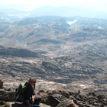
Zach Farrand searching for bats on the Beartooth Plateau, above Clarks Fork Canyon.
There is an overall lack of knowledge on bats in North America. In ecosystems, bats play a vital role as insectivores and can even be considered bioindicators of ecosystem health. Little distribution data exists in the Beartooth Mountains, which may provide seasonal food and water sources for bats. I will use acoustic survey techniques to compare bat species diversity and abundance (May – July) within four different elevation bands and three habitat types in two distinct areas within the Beartooth Mountains.
My study areas are the Line Creek Plateau and the West Rosebud Creek Drainage. These study areas exhibit two distinct landscape structures in the Beartooth Mountains. The Line Creek Plateau has little standing water, lots of open corridors, and is fairly close to the Pryor Mountains, which has the highest bat species diversity in Montana. The West Rosebud Creek Drainage has lots of standing water and the drainage itself should be useful to bats as a flyway when traveling between lakes.
By looking at temporal differences in elevation use, habitat selection, and larger landscape differences, we should learn meaningful information about critical resources in the Beartooth Mountains for bats.
*** Update --> Click here to view Billings Gazette articles on Zach's project.
Yellowstone River Osprey Project
Renee Seacor
Renee Seacor up in the mountains.
The Yellowstone River Osprey project is a collaborative project with the Yellowstone Valley Audubon Society and many other community members along the river.
The goal of our study is to continue to evaluate the health of the Yellowstone River ecosystem in Montana by monitoring a sentinel species, the osprey (Pandion haliaetus), and its habitat.
The study focuses on a 300 km stretch of the Yellowstone River, from Gardiner to Miles City, MT. The project relies heavily on citizen scientists to help with nest observations of over 71 nests.
*** Update --> Click here to view Billings Gazette articles on Renee's project.
Lands with Wilderness Characteristics: Habitat Patch Size, Human Travel Corridors, and the Spread of Invasive Plant Species in Eastern Montana
Robert Walker
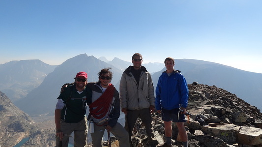
Robert Walker (l) and friends in the Beartooth Mtns.
I am interested in studying the relationship between human travel corridors( i.e.roads, ATV tracts, hiking trails, etc.) and the spread of invasive and noxious plants.
My summer research will examine the relationship between habitat patch size, plant community diversity, and weed invasion. I hypothesize that that the larger the area of a given habitat patch, the more diverse its floral community will be and therefore the greater its resistance to invasion by nonnative plants species (see: Theory of Island Biogeography).
My research will aid land managers by examining the 'threshold' floral habitat patch size required for protecting an island of habitat from weed invasion at its core. I will also be conducting road and wilderness characteristic surveys for the Montana Wilderness Association and the BLM. My research will be conducted on BLM lands in eastern Montana, near Broadus.
Botanical Monitoring and Conservation Education in the Pryor Mountains
Kelsey Flathers and Simone Durney
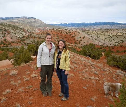
Keysey Flathers (l), Simone Durney (r), and Chip (far right) in the Pryors.
The Pryor Mountains vegetation ranges from arid red desert landscapes to subalpine forests and meadows as well as sagebrush communities, riparian cottonwood, mountain mahogany, limber pine and juniper all in just 145,000 square miles. The limestone canyons and uplifts contribute to unusual and diverse vegetation communities. These mountains are a place of high plant endemism; there are eight plant species in the Pryors and adjacent Northern Bighorn Basin that occur nowhere else on Earth.
This research project will measure diversity and identify species of concern in six distinct vegetation communities. The diversity between sites will be compared to establish an understanding of species abundance in the Pryor Mountains. The widely accepted line intercept and Daubenmire plot method will be used to quantitatively describe the six vegetation communities. We will sample each site twice, once at the beginning of the flowering season and once at the end.
Our study will provide initial data for future researchers to evaluate possible weed intrusion and changes in overall species composition over time. Results will help determine the effects of climate change in the Pryor Mountains. In addition our study will establish long-term baseline monitoring among these small intact vegetation communities. As a product of our work we hope to produce a guidebook for the area, which will feature flowering guides and a general history of the Pryor Mountains.
