Greater Sage-Grouse Conservation Policies: Mapping Divergent Subjectivities Across Stakeholder Groups
D'Jeane Peters
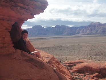
D’Jeane Peters in Canyonlands National Park near Moab, Utah.
The Greater
Sage-Grouse (Centrocercus urophasianus) is considered
an indicator species, which means their numbers are a focal point in sagebrush
ecosystem management plans. In Montana, Greater
Sage-Grouse numbers are down from historic levels by one third.
Due to this decline, advocates have filed a petition to list the Greater
Sage-Grouse under the Endangered Species Act (ESA). Doing so would dramatically
increase regulation on public and private land.
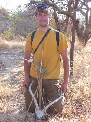
 Tyler Kethley, research assistant.
To prevent the Greater Sage Grouse from being listed, the state and federal governments have taken steps to develop conservation policies to protect the Greater Sage Grouse. However, not all stakeholders agree on what should be done to protect the birds. This raises the question of how Montanans, specifically those who have a stake in how Greater Sage-Grouse are managed, perceive the new recommendations and the public participation process? What do stakeholders agree about? Which elements of conservation polices are divisive?
This study will use a combination of qualitative and quantitative analysis to show which issues are divisive and which stakeholders agree upon. Semi-structured interviews will be used to gather basic demographic information and base-line opinions from stakeholders. Q-method (a ranking exercise) will be used to explore and compare stakeholder views on Greater Sage-Grouse policies and management preferences.
Ultimately, the study will: determine where stakeholder values converge and diverge regarding Greater Sage-Grouse conservation policies unfolding in the Yellowstone River watershed; examine stakeholder views regarding the effectiveness of public participation in environmental polices; support a Greater Sage-Grouse ecological assessment conducted by University of Great Falls (UGF) students during the summer of 2014. This research is supported in part by the Montana Wilderness Association.
Click the link below to read D'Jeane's publication of this research in Wildlife Society Bulletin.
| Peters and Ward (2017) |
Geometry, kinematics and timing of deformation in the Snowy Shear Zone: Northern Madison and Absaroka range, SW Montana
Dan Bentley
Dan Bentley in Clarks Fork Canyon, WY
The
Yellowstone River’s Paradise Valley is a product of ancient continental growth,
mountain building, and volcanism that forms an iconic backdrop to the greater
Yellowstone ecosystem. The mountains surrounding the Paradise Valley have a
geological history extending from the construction of the North American
continent (>2.5 billion years ago), to the formation of the modern-day
Rockies. However, details concerning this evolution are under debate. For
example, the Snowy shear zone (Ssz) and Deep Creek fault (DCf) define the
topographically abrupt eastern margin of the Paradise Valley. The Ssz is a
swath of rocks that deformed like plastic deep in the Earth, whereas the DCf is
a brittle structure superimposed on the shear zone. The Ssz was originally
interpreted to have formed over a billion years ago and inactive until roughly
50 million years ago when the DCf formed, broke through weaker rocks of the
Ssz, and formed the Paradise Valley. An alternative hypothesis states that the
Ssz formed only 50 million years ago. Both models produce the same relationship
of a brittle fault overprinting a ductile shear zone, but they have very
different implications for the development of the Paradise Valley.
This research is a collaboration with the USGS, MBMG, University of Florida, and the University of Massachusetts, involving geologic mapping, sample collection, and mineral chemistry analysis in the lab. The valley's tectonic evolution will be determined by constraining past motion along both the Ssz and DCf and reconstructing the paleo-geography by examining rotation in 45Ma volcaniclastic rocks, Miocene lake sediments, and recent lava flows erupted from the Yellowstone supervolcano. Young fault scarps and landslide deposits are also present in conjunction with the range-bounding structures. These will be studied in order to determine the potential for geologic hazards such as earthquakes and landslides.
This research is a collaboration with the USGS, MBMG, University of Florida, and the University of Massachusetts, involving geologic mapping, sample collection, and mineral chemistry analysis in the lab. The valley's tectonic evolution will be determined by constraining past motion along both the Ssz and DCf and reconstructing the paleo-geography by examining rotation in 45Ma volcaniclastic rocks, Miocene lake sediments, and recent lava flows erupted from the Yellowstone supervolcano. Young fault scarps and landslide deposits are also present in conjunction with the range-bounding structures. These will be studied in order to determine the potential for geologic hazards such as earthquakes and landslides.
Osprey Project: Osprey Prey Deliver, Fledgling Success Rates and Environmental Exposure to Contaminants and Stress
Linnea Warlick and Matt Dewitt
Linnea Warlick in a cave.
Linnea: "The Osprey project is an ongoing research project that I hope to make a contribution to in 2014. The health and behavior of species such as osprey (Pandion haliaetus), can provide valuable insight of the ecological integrity of an ecosystem. It is my goal to explore this relationship through behavioral observations and hematological analysis. I plan to examine white blood cell counts in relation to heavy metal loads in blood drawn from chicks. White blood cell counts can be used as a stress indicator and also are expected to correlate with heavy metal loads. By looking at this relationship and potential trends in heavy metal contaminant levels I hope to gain further insight into what may be driving osprey reproductive success."
 Matt DeWitt, at large in the bush, Africa.
Matt: "The Osprey Project is a long-term study with many partners. The study area stretches along the Yellowstone River which is the longest free flowing river in the lower 48 states. My research partner and I will be continuing in the footsteps of past Osprey Project student researchers from Rocky Mountain College, with a slightly new focus. For my research I will specifically focus on the Central Place Foraging and Optimal Foraging Theory. Central Place Foraging Theory focuses on animals that must return to a specific site such as a den or nest to consume or store their food. Optimal Forage Theory states that animals will forage as to maximize their energy intake per unit of food while keeping energy costs at a minimum. A study of both of these theories as applied to osprey will help us better understand possible limiting factors for reproductive success. I will be observing randomly selected active Osprey nest sites, fledgling success rates, forage species, and size of food loads in relation in relation to location on the river, distance to the river, and water clarity. "
Wolverine and Canada Lynx Distribution in the Absaroka-Beartooth Wilderness
Simone Durney
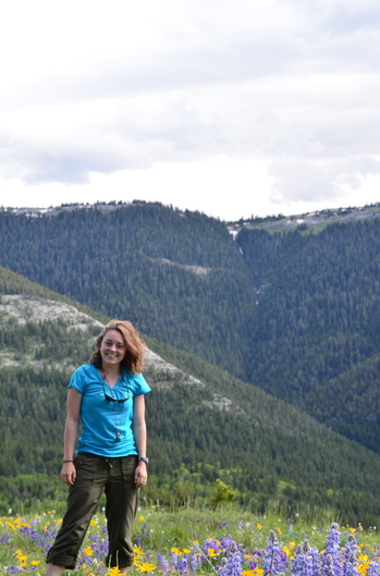
Simone Durney in the Pryors Mountains, south of Billings, MT.
Wolverines (Gulo gulo) and Canadian lynx (Lynx
canadensis) are elusive high elevation predators. The effects of global
climate change and changes in vegetation cover threaten their preferred
habitat. The Absarokee-Beartooth Wilderness area contains some of the last
remaining critical habitat for these predators in the contiguous United States.
Since 1880, six wolverine observations
have been recorded in the Absarokee-Beartooth Wilderness, while only three lynx
observations have been recorded since 1999. The lack of knowledge is
problematic in wilderness areas, because wilderness managers throughout the
state are currently under pressure to develop management plans to protect these
elusive predators and their habitat.
The wolverine and Canadian lynx project incorporates citizen science to gain knowledge of these species distribution and increase public awareness about their current existence in the area. The project will work closely with the United States Forest Service, Montana Wilderness Association - Eastern Wildlands Chapter, The Greater Yellowstone Coalition and the Absarokee-Beartooth Wilderness Foundation.
The wolverine and Canadian lynx project incorporates citizen science to gain knowledge of these species distribution and increase public awareness about their current existence in the area. The project will work closely with the United States Forest Service, Montana Wilderness Association - Eastern Wildlands Chapter, The Greater Yellowstone Coalition and the Absarokee-Beartooth Wilderness Foundation.
The study area for this first year is the eastern portion of the Absarokee-Beartooth Wilderness, which will range from the East Rosebud Drainage to Cooke City and back to Red Lodge. Camera stations and hair snare stations will be placed in areas of suitable habitat and monitored by student researchers and citizen scientists. Collecting DNA and photographic evidence will provide insight into these elusive predator’s distribution and help identify areas of critical for habitat management.
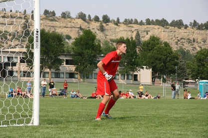
Lynx Research Assistant Sean Flynn in goal.
|
Wolverine Research Assistant Blake Brightman on the way to Half-Dome, Yosemite National Park.
|
Chemical advantages, invasion success, and ecosystem impacts of Russian olive
Ksenia Lynch
Ksenia Lynch, somewhere in Montana
Non-native species are of great concern because they impact the ecosystems they invade. Non-natives can decrease agricultural yields and pose significant public health risks, and they can influence ecosystems by physically altering habitats, hybridizing with native species, and displacing native species. In Montana, Russian olive is a non-native species of special concern. Now the third most common riparian tree species in the western US, it is widely credited both with causing the decline in native cottonwoods and altering plant and animal communities in riparian forests.
The main objective of the study is to evaluate how has Russian olive invaded and became established so quickly; and, eventually, what can be done to prevent it? My initial experiments suggest that Russian olive is a successful invader because it releases chemicals that both inhibit plants that may compete with it and that deter herbivores that may damage it. This summer plans are to investigate whether these inhibitory chemicals might have larger effects on the ecosystem by inhibiting the activity of the soil microbial community. Samples will be collected at sites along the stretch of Yellowstone River, between Billings and Columbus, where Russian olives and cottonwoods occur. Using Biolog Ecoplates I will assess soil microbial community activity.
These experiments were carried out with support from the Montana Space Grant Consortium, and the results were presented at the Murdock College Science Research Program Conference and the Montana Space Grant Consortium Student Research Symposium.
