
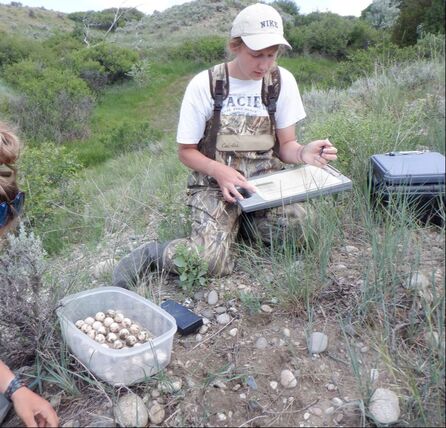
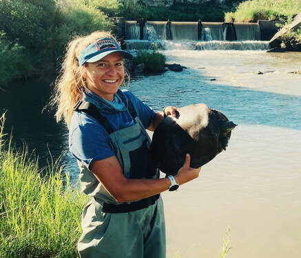
Monitoring Spiny Softshell Turtle Nesting Habitat Above and Below a Low-head Diversion Dam in Montana
Kendall Ard
My study focused on spiny softshell nesting ecology, success, and the potential impacts of an irrigation barrier on a small riverine system. Little is known about the nesting ecology of the spiny softshell turtle in northern latitudes of North America, particularly in smaller creeks.
I used Reconyx Hyperfire HC6000 game cameras to monitor potential nesting habitat (gravel beaches) at eight beaches (four above and four below the dam). Spiny softshell turtles prefer islands or banks with mixed gravel substrates with little vegetation for nesting. I recorded a total of 152,000 images and documented 43 behavioral events (15 nesting, 24 basking, and four swimming). All sites located above the barrier (Sites 1-4) had activity and two out of four sites below the barrier had activity. Overall, five nesting-related events were captured upstream of the barrier and 10 nesting-related events were captured below the barrier.
Peak flow discharge for late spring on the Yellowstone River near Billings, MT occurred at 60,200 ft3/sec on June 3, 2020. Timing of nesting occurred after peak flow of the Yellowstone River between June 11–19, 2020. High water events which inundated nests occurred between June 18–19 and June 29 – July 1, and for half of the day on July 7, 2020. All sites above the barrier were inundated and only one site below the barrier was inundated. The average time of day for nesting activity was 1630, mean temperature =37.2° and mean nesting duration =45 min. Surprisingly, no nest depredation was documented.
This information will contribute to a better understand of the effects of a low-head diversion dam on spiny softshell turtle nesting success. Previous studies on Pryor Creek have identified a noticeable difference in the number of juveniles above and below the irrigation barrier. With information on nesting success differences we can better understand the impacts of low-head diversion dams on spiny softshell turtles. I presented my results to a freshman environmental science class at Rocky Mountain College.
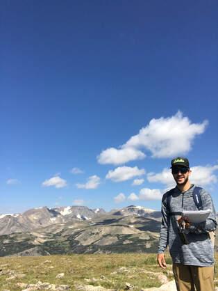
Evaluating the Effects of Climate Change on Alpine Plant Phenology in the Beartooth Mountains
Evan Matos
Alpine environments are incredibly vulnerable to climate variability and are some of the first areas where climate change is being recognized for its impact on an ecosystem. These alpine areas have large amounts of snowfall that historically did not become snow free until mid to late July. When snow cover subsequently becomes snowmelt the timing and rate of snowmelt differs across the landscape, which affects the timing of plant growth and phenological phases. Alpine plant species that exist in these environments are highly specialized and may be particularly sensitive and vulnerable to climate change.
My study looked at alpine plant phenology in the Beartooth Mountains by tracking the growth of five indicator species across N, S, E, W aspects on the four Beartooth GLORIA summits. This data was then compared to the 2018 pilot study data to quantify changes in response to the current climate condition. Additionally, a remote sensing workflow to analyze land-surface phenology utilizing MODIS NDVI data to link landscape scale phenology trends across the Beartooth Mountains to ground-based phenology measurements on the Beartooth Plateau was developed.
I found that indicator plant species growing on east facing aspects progressed to open flowers and ripe fruits faster than plants growing on other aspects. Also, differences in snowmelt timing in 2018 and 2020 appeared to have an effect on the phenophase timing of several indicator species. When looking at snowmelt by aspect, east facing aspects, which only receive morning sunlight and have higher snowpack due to prevailing wind direction, melted out last in both 2018 and 2020.
The establishment of a long-term phenological study on the Beartooth Plateau could provide valuable insight into the potential effects of climate change on sensitive alpine plant communities, which makes the continuation of this research of high importance. I presented these results at the Murdock College Science Research Conference.
Effects of a Low-Head Dam on a Sympatric Population of Turtles
Reece Robinett
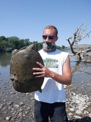
This study examines the effects of a low-head diversion dam on a sympatric population of spiny softshell turtles and snapping turtles in Pryor Creek (Huntley, MT). Little research exists regarding the effects of dams and aquatic barriers on turtles, and this was the first study to look at population connectivity between turtles above and below a dam. Turtles in Montana are threatened and isolated due to dams, and the population on Pryor Creek is particularly vulnerable because of its smaller population size. Summer trapping and year-round radio tracking of both species was used to collect data. Over 100 turtles were captured and nearly 40 turtles were radio-tagged.
Preliminary results confirmed the dam is restricting the movement of both species. No snapping turtles have been documented bypassing the dam, and surprisingly, at least five adult female spiny softshell turtles have accomplished navigation past the dam in at least one direction. The dam may also affect population demographics though changes in habitat availability (nesting and hibernacula sites). In three years of surveys no juvenile spiny softshells were found above the dam, and over 80% of the snapping turtle population is male above the dam.
This research can be used to better understand fragmented turtle populations and to appropriately manage aquatic barriers for turtles. I presented results at the Murdock College Science Research Conference, the National Conference on Undergraduate Research, the Montana Chapter of the Wildlife Society Conference, and collaborated in a number of outreach opportunities for undergraduate, high school and the general public.
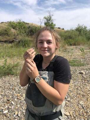
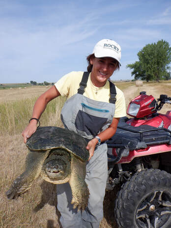
Nesting Habitat of Snapping Turtles (Chelydra serpentina) Near Prairie Streams in Montana
Lauren Ryter
Snapping turtle nesting habitat has never been studied in Montana, and little is known about their reproductive success on prairie streams. Timed visual surveys were conducted for reptile eggs and nests from May – June and September – October in areas with known healthy populations of snapping turtles.
We categorized nesting activity as, attempted, predated and hatched, based on egg shell characteristics. Searches resulted in the location of 57 nests, 37 of which were snapping turtle nests and the others consisted of (western hognose snakes, eastern racers and gopher snakes).
For snapping turtle nests, I analyzed slope, aspect, distance to water, proximity to other nests, and surrounding vegetation. Preliminary results identified key habitat nest characteristics with a mean slope of 17.58 degrees, a south or southwestern aspect, and mean distance to water of 17.54 m, with little to no vegetation. For snapping turtles, I identified several “hotpsots,” areas where turtles appeared to nest in close proximity. This may indicate limited suitable habitat availability and will help us focus searches for next year. I presented my results to a freshman Environmental Science class and an Intro to GIS class.
Spiny Softshell Turtle (Apalone spinifera) Nesting/Basking Habitat Availability in Dammed and Undammed Rivers
Larissa Saarel
Riverine turtles’ life cycles are highly adapted to the dynamic river systems in which they live. The diverse habitats which are produced through a spring-flood pulse river, with minimal anthropogenic modifications, produce complex habitat used by spiny softshell turtles (Apalone spinifera). Unfortunately, these are the very habitats which are limited by the effects of dams on rivers. Little research exists on spiny softshell turtle population structure related to anthropogenic modifications. More specifically, how does nesting and basking land cover availability and reproductive potential of spiny softshell turtles vary between a dammed (Bighorn River) and undammed (Yellowstone River) system?
For my study, available nesting/basking land cover was analyzed along 20-mile stretches on the Yellowstone and Bighorn rivers. This was then compared to population demographics and capture rates of turtles on both rivers. Preliminary results identified a significant difference in the nesting/basking area in comparison to the total available area. In addition, numbers of islands were significantly different between the two rivers. The limited availability of area suitable for nesting/basking correlated with limited juvenile size classes and recruitment on the Bighorn River. It appears that dam altered habitat conditions (flow, temperature and nesting beaches) are producing an environment challenging for juveniles, recently recruited individuals, as well and males (smaller sizes). This raises concerns about long-term population persistence.
Through a better understanding of how spiny softshell turtles are affected by the influence of dams, changes in management can be explored to enhance conservation of these turtles in rivers. I presented these preliminary results to a freshman environmental science class at Rocky Mountain College as well as the 2020 Montana Space Grant Consortium (NASA) workshop students from around Montana.
Evaluation of Snapping Turtle (Chelydra serpentina) Fitness in Association with Temperature and Flow Regimes
Addison Valdez
The influence of water temperature and flow on aquatic species is widely acknowledged. Anthropogenic modifications such as dams and agriculture inputs/outputs can influence temperature and flow regimes of rivers. Many factors related to freshwater turtle fitness are affected by thermal regimes, such as maturity rates, growth rates, and reproduction. My main focus was to gain insight into the relationship between thermal and flow regime differences in small creeks to see how they may relate to population status of snapping turtles (Chelydra serpentina) in southeastern Montana.
I collected temperature and flow data at an upper and lower location on four separate creeks in the Billings area: Razor, 5-Mile, Pryor, and Canyon Creek. Upper and lower site data was compared on each creek and amongst the four creeks. Preliminary results (from just a few months) indicated water flow of Canyon and 5-Mile were significantly different between upper and lower sites. All creeks flowed faster at the lower site than the upper except Pryor Creek. Three creeks exhibited a significant difference in temperature between sites (Razor, Pryor, and Canyon). All creeks except Canyon Creek had higher temperatures at the lower sites. These flow and temperature changes between upper and lower sites appear to be strongly affected by agricultural (irrigation) activity altering the natural water regimes of the stream systems. Snapping turtle presence and absence is different in these creeks and overall fitness of each population may be related to the flow and temperature regimes. I plan to continue this study to have profiles for a full year of flow and temperature differences.
With more insight on how snapping turtles are affected by anthropogenic regime changes, efforts can be made to improve agricultural practices and management of these small stream systems. I presented these preliminary results to a herpetology class at Rocky Mountain College and at the 2020 Montana Space Grant Consortium (NASA) workshop.
