Ten Year Alpine Vegetation Trends on Mountain Summits on the Beartooth Plateau
Addison Valdez
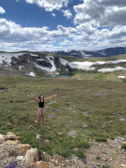
The intensification of anthropogenically induced climate change is affecting all life on Earth, particularly in alpine environments. Alpine environments are considered to be some of the most pristine and intact ecosystems left on the planet, yet there are concerns that alpine plant communities and their functioning are being negatively affected by climate variability. To properly understand the effects of climate change, long-term field-based surveillance and/or experimental studies of globally universal sites are necessary (GLORIA 2021).
|
In 2001, the Global Observation Research Initiative in Alpine environments (GLORIA) was launched to assess climate change impacts and monitor changes in alpine ecosystems across the world. GLORIA primarily aims to establish a vital foundation for documenting and analyzing significant changes in alpine vegetation. While anthropogenic influences are more limited in the alpine life zone, climate warming may primarily be altering alpine zones via extent changes and fragmentation. Temperature rises can halt the growth of cold-adapted alpine vegetation while simultaneously promoting competition and invasion of plant species from lower elevations where they have not previously existed. Although species richness is potentially growing at small regional scales, biodiversity is rapidly decreasing as a whole across the world. Overall, climate change-induced threats to alpine biodiversity could significantly impact the planet’s natural heritage and are in need of long-term field study continuation to make sound conservation and management decisions (GLORIA 2021). My primary research objectives are to quantify changes in 1)alpine vegetation communities and 2)soil temperature/snowmelt on Beartooth Plateau summits over a ten-year period. To assess alpine vegetation composition changes in the Beartooth Mountain range in accordance with the GLORIA monitoring project, the standardized multi-summit approach will be utilized.
|
Nesting Habitat of Snapping Turtles (Chelydra serpentina) Near Prairie Streams in Montana
Lauren Ryter
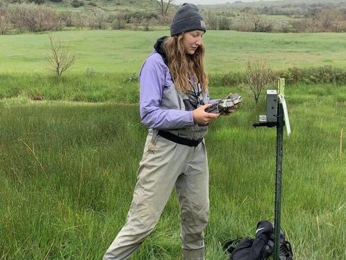
Snapping turtle nesting habitat has never been studied in Montana, and little is known about their reproductive traits on prairie streams. This was my second year analyzing nesting habitat. I identified three “hotspots,” with frequent nesting activity in year one, and more closely monitored those sites this year. From May to the end of June I conducted timed visual surveys for reptile eggs at hotspot sites and other areas with similar habitat characteristics. When nests were found I analyzed slope, aspect, distance to water, proximity to other nests, and measured vegetation with a Daubenmire plot. Nests were marked with flags, and game cameras were placed at three of the “hotspots” to help monitor nesting.
For each nest we discovered we created another random point to assess habitat differences of nests and the overall habitat availability on the landscape. Nesting activity was categorized as, attempted, predated and hatched, based on egg shell characteristics and observed turtle behavior. Any freshly constructed snapping turtle nests were carefully excavated to count and measure eggs and then carefully reburied with a HOBO temperature logger inside. In the fall I resurveyed sites to document hatching success and/or predation.
Seven different “hotspots” were found this summer where multiple snapping turtle nests were found, with a mean distance from one another of 3.04 meters. In total we found 19 nests and eight nest attempts, with a predation rate of 75%. We documented nest predation by skunks, and a badger and we suspect other species are involved . The largest numbers of eggs we documented in one nest was 82. Nests were mainly found on hills and bluffs with southern aspects, an average slope of 23.6 degrees, and a mixed substrate of dirt and fine cobble. Daubenmire nest/random site comparisons indicated that nest site ground cover consisted of over 60% bare ground, while random sites were much more vegetated with only 11% bare ground. Suitable nesting habitat at this research site seems limited and thus it is important that we help landowners understand the value of these sites and how to limit disturbance of them. By understanding where snapping turtles are nesting, we will be able to work with landowners and the community to help preserve the habitat snapping turtles depend on.
Seven different “hotspots” were found this summer where multiple snapping turtle nests were found, with a mean distance from one another of 3.04 meters. In total we found 19 nests and eight nest attempts, with a predation rate of 75%. We documented nest predation by skunks, and a badger and we suspect other species are involved . The largest numbers of eggs we documented in one nest was 82. Nests were mainly found on hills and bluffs with southern aspects, an average slope of 23.6 degrees, and a mixed substrate of dirt and fine cobble. Daubenmire nest/random site comparisons indicated that nest site ground cover consisted of over 60% bare ground, while random sites were much more vegetated with only 11% bare ground. Suitable nesting habitat at this research site seems limited and thus it is important that we help landowners understand the value of these sites and how to limit disturbance of them. By understanding where snapping turtles are nesting, we will be able to work with landowners and the community to help preserve the habitat snapping turtles depend on.
Tributaries and Drainages of the upper Bighorn River, Montana: An assessment of flow and water quality
Hunter Jackson
I am analyzing water quality and flow of two Irrigation Mile Lines and two tributaries of the Bighorn River from May to September. Analysis of the creeks and mile lines will occur monthly to establish a baseline. In addition, I will sample after rainfall temporal events over a threshold rainfall of (0.25”) in order to capture the amount of water flowing back into the river from these systems and assess the water quality. In addition to mile line and creek sampling I will regularly sample water quality at Bighorn Lake. I am using a YSI Multi Parameter Sonde as well as a portable flow meter to analyze water flow, temperature, turbidity, dissolved oxygen, blue green algae, chlorophyll, and PH. In addition to field testing, I will send water samples to Energy labs where my colleague Nikayla Beyers will analyze them for phosphorous and nitrogen. Water quality and flow monitoring of these sites will help us better understand the natural and human influences on the upper Bighorn River.
Hibernacula Fidelity and Home Ranges of Snapping Turtles (Chelydra serpentina) in Eastern Montana
Kara Holmlund
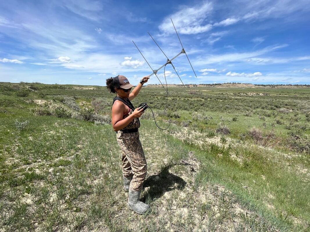
The snapping turtle populations in northern latitudes, such as Montana, are faced with longer and more extreme winter conditions compared to their southern counterparts. Due to these conditions, an important aspect of these turtles' overall survival is being able to overwinter, waiting until normal conditions return. The location of where turtles choose to overwinter is called hibernacula. Many studies have been conducted focusing on the characteristics of turtle hibernacula in various populations, but few have examined northern latitude populations, and none have been conducted in Montana. My study will focus on the snapping turtle population located just east of Billings, MT. In the first year of my study, used radio-telemetry location data collected over the last three years. I will collect more locations this summer and calculate home ranges for all marked turtles. I will also assess key characteristics of habitat availability and selection. Based on these assessments I will be able to determine if turtles are using the same ranges each year and the same hibernacula sites and potentially proximity to known nesting sites.
Water Quality Monitoring on the Yellowstone
and Bighorn Rivers
NIkayla Beyers
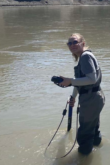
The focus of my summer research project is to analyze how water quality changes on the Yellowstone and Bighorn rivers in relation to flow rates. Seven sites were chosen on the Yellowstone River and eight sites on the Bighorn River. I will monitor water quality at these sites from May until the end of September, allowing for an analysis of water quality during pre-peak flow, peak flow, and post-peak flow conditions. The comparison between these two rivers will provide important data on how water quality changes based on natural flows in comparison to flows that are regulated by the releases of the Yellowtail Dam on the Bighorn River.
Using a YSI EXO Multiparameter Sonde, I will assess the water quality parameters of dissolved oxygen, water temperature, turbidity, specific conductivity, chlorophyll, and blue-green algae two times each month. In addition, will collect chemistry grab samples at each of the locations once a month and analyzed these for Nitrate-Nitrite and total phosphorus at Energy Labs. Further data analysis will be required to identify any correlation between the different water quality parameters and between parameters on each river location and time of year. T-tests and ANOVA tests will be used to identify any correlations once further data collection has been completed.
Using a YSI EXO Multiparameter Sonde, I will assess the water quality parameters of dissolved oxygen, water temperature, turbidity, specific conductivity, chlorophyll, and blue-green algae two times each month. In addition, will collect chemistry grab samples at each of the locations once a month and analyzed these for Nitrate-Nitrite and total phosphorus at Energy Labs. Further data analysis will be required to identify any correlation between the different water quality parameters and between parameters on each river location and time of year. T-tests and ANOVA tests will be used to identify any correlations once further data collection has been completed.
Integrating Three Scales of Analysis (Ground-truthing, UAS, and Sentinel Imagery) to Assess Spiny Softshell Turtle (Apalone spinifera) Nesting Habitat in a Dammed and Undammed River
Larissa Sarrel
My project will use unmanned aerial system (UAS)-gathered imagery and remote sensing workflows, as well as ground-truthed data to address these objectives: 1) Develop a rigorous random sampling protocol that is statistically sound for determining UAS drone flights, 2) Document spiny softshell nesting activity sites and habitat, 3) Refine Sentinel classifications of potential nesting habitat to identify total available nesting habitat, and 4) Delineate the extent of available nesting habitat.
I will compare the available nesting habitat for spiny softshell turtles on the Yellowstone (undammed) and the Bighorn (dammed) rivers. In general, dam operations and their effects on sediment mobilization and the timing of peak flows may result in declines of the reproductive potential of riverine turtles such as the spiny softshell (Melancon et al. 2013). In order to assess available nesting habitat, I will use UAS (drones) to acquire high resolution imagery in order to produce a nesting habitat classification model. UAS will also allow me to collect precise and accurate nesting habitat data on-site during the time following peak flows when spiny softshells are nesting. Peak flows usually occur in mid-June, so sampling will take place early-middle of July. In contrast, NAIP and other publicly available, high-resolution imagery are often not available in the time frame needed.
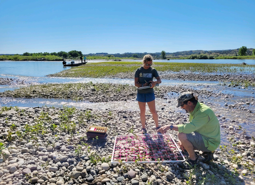
This past spring, my colleagues and I worked with a statistician to create a stratified sample regime which helped us to randomly generate roughly 20 points on each river on areas identified as potential suitable nesting habitat by Sentinel imagery. In addition to UAS imagery taken at each of these sites, we delineated the extent of nesting habitat used by spiny softshells and measuring nest site metrics such as elevation from water level, slope, and vegetation cover. At each ground-truthing location, I will follow NASA GLOBE protocols for systematically photo-documenting land cover (habitat). Following The GLOBE methodology, these ground-truth site photos will be uploaded and stored in the GLOBE cloud-based storage database. Data in the GLOBE system can be used by the greater NASA network of scientists to improve satellite imagery interpretation at the sub-pixel scale.
This will be my final summer working on this research project which we have developed over the past two summers. I will work with the other partners on this project to compile and analyze our results to create a model which can be applied across additional rivers to determine the approximate availability of spiny softshell nesting habitat.
I will compare the available nesting habitat for spiny softshell turtles on the Yellowstone (undammed) and the Bighorn (dammed) rivers. In general, dam operations and their effects on sediment mobilization and the timing of peak flows may result in declines of the reproductive potential of riverine turtles such as the spiny softshell (Melancon et al. 2013). In order to assess available nesting habitat, I will use UAS (drones) to acquire high resolution imagery in order to produce a nesting habitat classification model. UAS will also allow me to collect precise and accurate nesting habitat data on-site during the time following peak flows when spiny softshells are nesting. Peak flows usually occur in mid-June, so sampling will take place early-middle of July. In contrast, NAIP and other publicly available, high-resolution imagery are often not available in the time frame needed.
This past spring, my colleagues and I worked with a statistician to create a stratified sample regime which helped us to randomly generate roughly 20 points on each river on areas identified as potential suitable nesting habitat by Sentinel imagery. In addition to UAS imagery taken at each of these sites, we delineated the extent of nesting habitat used by spiny softshells and measuring nest site metrics such as elevation from water level, slope, and vegetation cover. At each ground-truthing location, I will follow NASA GLOBE protocols for systematically photo-documenting land cover (habitat). Following The GLOBE methodology, these ground-truth site photos will be uploaded and stored in the GLOBE cloud-based storage database. Data in the GLOBE system can be used by the greater NASA network of scientists to improve satellite imagery interpretation at the sub-pixel scale.
This will be my final summer working on this research project which we have developed over the past two summers. I will work with the other partners on this project to compile and analyze our results to create a model which can be applied across additional rivers to determine the approximate availability of spiny softshell nesting habitat.
